Route
Cluster before you add more
Start with the neighborhoods and anchor places that matter most, then use the map to see which additions are genuinely nearby.
New York · The Navly guide
Explore a real three-day Manhattan plan. Find the stops, follow the walks and see how a slower day changes the route.

A real Navly plan · October 14–16
6 min walking · 2026-10-14
2 min walk
4 min walk
4 min walk
15 min walk
9 min walk
23 min walk
Apple Maps · select a stop to explore
Times are estimates. Check opening hours and admission before visiting.
Apple Maps routes captured October 5, 2026 · not live directions.
“Three relaxed days in Manhattan. Museums, parks, coffee and walking routes.”
Create and save a 3-day solo New York trip for October 14–16, 2026. Focus on compact daily walking routes in Manhattan with museums, parks and coffee. Use Apple Maps to discover and verify the places and connecting routes. Keep each day relaxed, with 3 or 4 visits and time for breaks. No hotel, flights or bookings. Use English titles. This is a public Navly product example.
Navly proposed removing the final visit on day 2 and its walking connection. The remaining route and the other days stay in place. Compare the actual proposal above; it has not been applied to the saved trip.
New York is full of places worth seeing, but the quality of a day depends on how well the route handles cross-town travel, timed entries, and the neighborhoods between headline stops.
What changes the day
Start with the neighborhoods and anchor places that matter most, then use the map to see which additions are genuinely nearby.
Keep reservations, opening windows, and travel buffers beside the activities they constrain instead of hiding them in notes.
When a day crosses the city, ask Navly to compare walking, transit, and road options before you commit to the order.
Flights, stays, documents, and shared plans can all sit in one timeline while the day route changes around them.
Route ideas
Build a day around a single area, then add only the stops that fit its pace and walking pattern.
Compare two landmark combinations and keep the route leg between them visible before choosing the better day.
Keep a primary route and a nearby alternative so the day can adapt without rebuilding the whole itinerary.

New York, United States
Plan Halloween in New York City: the Village Halloween Parade on October 31, Green-Wood Cemetery in Brooklyn and a day trip to Sleepy Hollow.
Itineraries · 2 min read
New York, United States
A measured one-way Brooklyn Bridge walk from City Hall Park to DUMBO and the Brooklyn Heights Promenade, with direction, timing and return options.
Walking routes · 3 min read
Questions to take into Navly
Carry the plan into the product
Plan before you travel or start with the time you have after arriving. Keep the places you want to visit, your daily route and itinerary together. Explore solo or with company, and review proposed changes as your day unfolds.
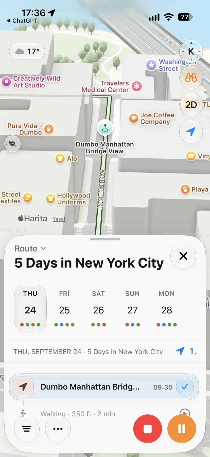
New York
A five-day itinerary, with each day's stops and walking connections together. Select a date to see its activities in order, then find the selected stop on the map.
Explore another real New York plan: three days in ManhattanKeep exploring
Published route measurement
A one-way Lower Manhattan-to-Brooklyn route that treats the Brooklyn Bridge crossing, DUMBO waterfront, and Brooklyn Heights finish as one connected decision.
Estimates cover the named pedestrian sequence only. They exclude queues, time inside places, live transit, temporary closures, construction, weather delays, and the return journey. Values were reconciled against the linked route guidance, rounded for planning, and reviewed 2026-08-30.
Why this order?
Starting at City Hall uses the clearest Manhattan-side bridge approach, lands in DUMBO without backtracking, and leaves the waterfront and Brooklyn Heights as an intentional finish rather than an extra round trip.
Accessibility caveat
Step-free continuity has not been verified end to end. The bridge uses long ramp approaches, while curb cuts, construction, gradients, and the chosen DUMBO-to-promenade streets can change the accessible path.
The bridge is exposed to wind, heat, and rain with almost no shelter. Crowding can add substantial time even when the pure walking estimate stays unchanged.
Start: City Hall Park
Finish: Brooklyn Heights Promenade
Route alternative
Why choose this route?
Use this west-side route when a linear elevated park and waterfront finish fit the day better than an East River crossing.
Access and weather
Elevator availability and the step-free connection between each anchor must be checked on the day; the published estimate does not certify an accessible itinerary. The elevated and waterfront sections are exposed. Chelsea Market provides an indoor pause, but it does not make the full route weather-proof.
Transport entry and exit
| Entry or exit | Practical approach | Trade-off |
|---|---|---|
| Lower Manhattan | Use Brooklyn Bridge–City Hall, Chambers Street, or nearby Lower Manhattan transit, then begin at City Hall Park. | Current service and station accessibility must be checked separately from the walking estimate. |
| Brooklyn first | Reverse the route when skyline views toward Manhattan matter more than finishing in DUMBO. | The route order and onward neighborhood logic change; do not treat it as the same day in reverse. |
| Brooklyn Heights finish | Leave from Clark Street, High Street, Borough Hall, or a ferry connection after the promenade. | The return to Manhattan is not included in the 3.6 km estimate. |
Official source trail